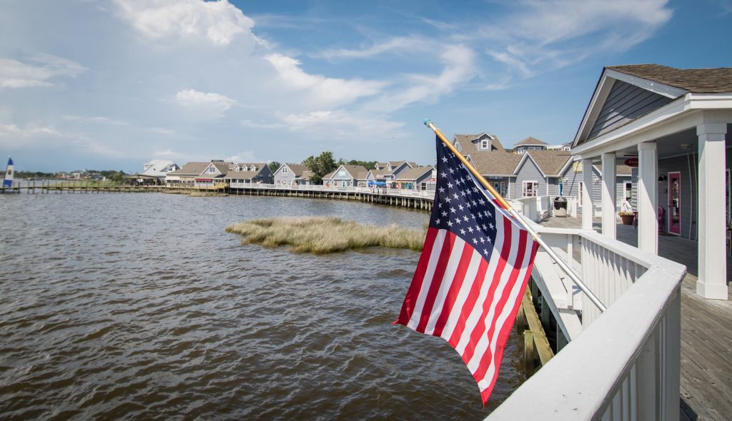
Severe Weather Information
Please check this page regularly for updates if severe weather is forecast. Each link will open a new page.
Weather information can be found on the National Hurricane Center and the Weather Channel websites:
National Hurricane Center | Accuweather.com | Stormpulse.com | Weather Channel.com
Local emergency bulletins may be found on the Dare and Currituck County websites as well as the Town of Duck website:
Dare County Website | Currituck County Website | Town of Duck Website
NC Department of Transportation:
Evacuation Maps | Travel Alert Info | Dare County Travel Info | Currituck County Travel Info
Travel Insurance Info:
Claim Procedure | Hurricane Coverage Flyer | Website Information
Hurricane information for current Twiddy Guests:
2011 Guest Directory Hurricane Info | Frequently Asked Questions | What to do once the storm has passed?
Visit our Twiddy blog for daily live video updates:


Dare County Emergency Management update video (9/1/11):

Twiddy & Company Bulletins appear below:
|
Bulletin No. |
021 |
|
Date/Time: |
Saturday, September 3, 2011 10:00 a.m. |
|
Bulletin Subject: |
Hurricane Irene |
|
Bulletin Information: |
It is business as usual for Twiddy & Company. Fewer than 10 homes are temporarily not available for occupancy. Guests affected for the duration of unavailable status will be notified. |
|
Bulletin No. |
020 |
|
Date/Time: |
Thursday, September 1, 2011 1:30 p.m. |
|
Bulletin Subject: |
Hurricane Irene |
|
Bulletin Information: |
All Guests scheduled for arrival this weekend will be sent an e-mail later today confirming their rental reservation. Guests have already been notified if they are scheduled to occupy one of the very few homes that are not ready for occupancy. All Guests arriving for future dates will be sent a confirming e-mail no later than mid-week next week. |
|
Bulletin No. |
019 |
|
Date/Time: |
Wednesday, August 31, 2011 9:30 a.m. |
|
Bulletin Subject: |
Hurricane Irene |
|
Bulletin Information: |
Twiddy offices are open and we are checking in our Guests for homes that have been designated as undamaged and housekeeping completed. See the previous bulletin below for cautionary information. Guests scheduled to arrive this weekend, September 3-5, will be notified as soon as possible by e-mail if your home is not available for occupancy. There are very few homes that are not ready for occupancy. All Guests scheduled to arrive this weekend will be sent a confirming e-mail tomorrow (Thursday). Guests for future dates will be sent a confirming e-mail no later than mid-week next week. Watch this site for additional information that may be updated prior to e-mails being sent. |
|
Bulletin No. |
018 |
|
Date/Time: |
Tuesday, August 30, 2011 5:00 p.m. |
|
Bulletin Subject: |
Hurricane Irene |
|
Bulletin Information: |
Twiddy offices are open and we are checking in our Guests for homes that have been designated as undamaged and housekeeping completed. Homes will continue to be ready for occupancy throughout the day. See the previous bulletin below for cautionary information. The Vacation Home Status list applies to Arrivals for 8/26-8/28 check-ins only. Guests scheduled to arrive for future dates will be notified if your home is not available for check-ins. |
|
Bulletin No. |
017 |
|
Date/Time: |
Tuesday, August 30, 2011 12:00 p.m. |
|
Bulletin Subject: |
Hurricane Irene |
|
Bulletin Information: |
Twiddy offices are open and we are checking in our Guests for homes that have been designated as undamaged and housekeeping completed. Homes will continue to be ready for occupancy throughout the day. See the previous bulletin below for cautionary information. |
|
Bulletin No. |
016 |
|
Date/Time: |
Monday, August 29, 2011 6:15 p.m. |
|
Bulletin Subject: |
Hurricane Irene |
|
Bulletin Information: |
Dare and Currituck Counties and the Town of Duck will permit entry by visitors as of 10:00 a.m. on Tuesday August 30 to Southern Shores, Duck, Corolla and the 4 x 4 area (Carova). The link above that shows a status list of Twiddy vacation homes that have been checked for damage and are determined to be available for occupancy once necessary housekeeping has been performed. Only those homes that have been inspected and are undamaged are listed. We will continue to update this list until 8:00 pm tonight. If your vacation home has suffered damage such that it is not fit for occupancy, you will be notified by phone or e-mail as soon as such status is determined. We ask for your understanding when checking in. Some services - such as pool & spa service - may be delayed, deck furniture that was secured may need to be re-distributed, and, although bed and bath linens will be present, they may not arrive in time for bed-making to be accomplished upon your arrival. In addition, we wish to remind our Guests of the usual, unavoidable post-storm hazards that may exist, such as miscellaneous hazardous debris that may be present on decks, pool areas, driveways and lawns. Beach access may be restricted. Walkways to the beach and dunetop decks may not be safe to walk on. The dunes may be sheared and may give way at any time. Visitors should exercise caution at all times. The good news is you can expect a week of beautiful weather, a calm sea and a memorable family vacation adventure. |
|
Bulletin No. |
015 |
|
Date/Time: |
Monday, August 29, 2011 9:15 a.m. |
|
Bulletin Subject: |
Hurricane Irene |
|
Bulletin Information: |
Dare and Currituck Counties and the Town of Duck modified their evacuation orders to permit re-entry of residents and property owners only. Dare County will be open to visitors as of 12:00 p.m. Monday WITH THE EXCEPTION OF THE TOWN OF DUCK. THE TOWN OF DUCK WILL RE-OPEN TO VISITORS BEGINNING AT 10:00 A.M. ON TUESDAY, AUGUST 30, 2011. ANY VISITOR TRYING TO GET TO DUCK OR COROLLA, OR OTHER POINTS NORTH, BEFORE THEN WILL BE TURNED AROUND AT THE DUCK/SOUTHERN SHORES LINE. Thus, no Twiddy homes are accessible to visitors until that time. Twiddy offices will have a skeleton staff today, as most of our resources will be allocated to inspecting and cleaning our vacation homes. We will start posting the list of available homes later today. |
|
Bulletin No. |
014 |
|
Date/Time: |
Sunday, August 28, 2011 7:00 p.m. |
|
Bulletin Subject: |
Hurricane Irene |
|
Bulletin Information: |
Twiddy offices are closed today. The mandatory evacuation orders issued by Currituck County and the Town of Duck have been revised to allow re-entry as of 7:00 pm tonight FOR RESIDENTS AND PROPERTY OWNERS ONLY! This conforms to Dare County’s orders. Twiddy will begin damage assessment and housekeeping on Monday and post house status on this site as we make progress preparing for our incoming Guests. We do not have alternative accommodations to replace damaged homes, so please check the availability of your vacation home before you leave home. |
|
Bulletin No. |
013 |
|
Date/Time: |
Sunday, August 28, 2011 5:00 p.m. |
|
Bulletin Subject: |
Hurricane Irene |
|
Bulletin Information: |
Twiddy offices are closed today. At this time, the Town of Duck is not accessible because of impassable roads, damage, debris and a water line break. There is no access to Corolla. Until travel is allowed up NC12, Twiddy will not be able to inspect rental homes for damage and habitability. We will begin rental home inspections as soon as possible after access is granted and post our progress on this site. See the emergency information sites above. |
|
Bulletin No. |
012 |
|
Date/Time: |
Sunday, August 28, 2011 2:00 p.m. |
|
Bulletin Subject: |
Hurricane Irene |
|
Bulletin Information: |
The Dare County Control Group has announced the beginning of a limited re-entry procedure to portions of Dare County, to be done in priority phases, beginning at 2:00 p.m. Sunday, August 28 for Residents and Property Owners. However, The 2:00 p.m. limited re-entry procedure will not include access to the Town of Duck. The Town of Duck is not accessible, at this time, because of impassable roads. Therefore, there is no access to Corolla. See the Dare County link for priority stages of re-entry. Twiddy offices are closed today. We will begin rental home inspections on Monday and post our progress on this site. |
|
Bulletin No. |
011 |
|
Date/Time: |
Sunday, August 28, 2011 8:00 a.m. |
|
Bulletin Subject: |
Hurricane Irene |
|
Bulletin Information: |
Hurricane Irene passed over the Outer Banks last night. The hurricane warning was changed to a tropical Storm warning as of 5:00 am this morning. A mandatory evacuation order remains in effect. Assessment teams are out. Power is out in several areas; there is flooding and trees down. NC 12 is currently impassable. Re-entry will be delayed. See County and Duck updates for current information. Twiddy will not know the habitability status of our rental homes until the evacuation is lifted, power is restored, our staff has returned and has inspected each home for damage. Guests should not anticipate checking in on Sunday. We will post individual house status as information becomes available. |
|
Bulletin No. |
010 |
|
Date/Time: |
Saturday, August 27, 2011 9:00 a.m. |
|
Bulletin Subject: |
Hurricane Irene |
|
Bulletin Information: |
Hurricane Irene made landfall this morning south of the Outer Banks. Although it has been downgraded to Category 1 with 85 mph winds, it remains a threat to our area. See the updated bulletins from County Emergency Management. |
|
Bulletin No. |
009 |
|
Date/Time: |
Friday, August 26, 2011 11:45 a.m. |
|
Bulletin Subject: |
Hurricane Irene |
|
Bulletin Information: |
Hurricane Irene is still a threat to the Outer Banks of North Carolina. It is currently a category 2 hurricane, with a chance of strengthening before reaching the Outer Banks some time on Saturday. A mandatory evacuation has been called for all visitors and residents. It will likely be in place through Sunday and perhaps longer. This means that our incoming visitors should not anticipate checking in on Sunday. We will continue to monitor the storm and once the evacuation order has been lifted for residents, we will be busy assessing and cleaning all of our vacation homes as soon as possible so we can notify our incoming guests when they can expect to arrive. Please be patient as the assessment and weekday cleaning process after the last guests’ rapid departure will strain limited resources. Guests will be able to review the status of your vacation home via a special link that will be posted on this Severe Weather Information page. Incoming Guests should not leave their primary residence without first confirming that their rental home is undamaged and available for occupancy. Please see the link above for information on Travel Insurance. |
|
Bulletin No. |
008 |
|
Date/Time: |
Thursday, August 25, 2011 5:00 p.m. |
|
Bulletin Subject: |
Hurricane Irene |
|
Bulletin Information: |
A Hurricane Warning has now been issued for the North Carolina coast. The northern Outer Banks - from Cape Hatteras to the Virginia line - is under an evacuation order. Dare and Currituck Counties have issued mandatory evacuation orders for all visitors and residents. Therefore, Twiddy’s offices will be closed on Friday August 26 and will not re-open until such time as the evacuation order has been lifted and our staff can return to the Outer Banks, secure their personal property and return to work. However, we will continue to post updates as circumstances allow. See links above for updates on Hurricane Irene and emergency management information. Also see Bulletin #6 below for additional information. |
|
Bulletin No. |
007 |
|
Date/Time: |
Thursday, August 25, 2011 10:30 a.m. |
|
Bulletin Subject: |
Hurricane Irene |
|
Bulletin Information: |
A Hurricane Watch has been issued for the North Carolina coast. The northern Outer Banks - from Cape Hatteras to the Virginia line - is under an evacuation order. Dare and Currituck Counties issued mandatory evacuation orders for all visitors effective this morning Thursday, August 25. See links above and Bulletin #6 below for more information. |
|
Bulletin No. |
006 |
|
Date/Time: |
Thursday, August 25, 2011 7:30 a.m. |
|
Bulletin Subject: |
Hurricane Irene |
|
Bulletin Information: |
A Hurricane Watch has been issued for the North Carolina coast. The northern Outer Banks is under an evacuation order. Dare County has issued a mandatory evacuation order for all visitors effective 8:00 a.m. Thursday August 25th. It is very likely that Currituck County will follow this morning. Departing Twiddy Guests are asked to review instructions contained in the 2011 Guest Directory Hurricane Info link above. Namely,
Incoming Twiddy guests should also review the 2011 Guest Directory Hurricane Info link above for information on what happens after the evacuation is lifted. The duration of the post-storm process of assessing the habitability of our vacation homes will depend on the severity of the storm and the duration of the evacuation order. The status of individual homes will be posted on a special section of this website. Incoming guests should check the Twiddy site for information on the status of individual vacation homes before leaving home. Also, see above links for Travel insurance information. |
|
Bulletin No. |
005 |
|
Date/Time: |
Wednesday, August 24, 2011 8:30 pm |
|
Bulletin Subject: |
Hurricane Irene |
|
Bulletin Information: |
Dare county has issued a mandatory evacuation order effective 8:00 am on Thursday, August 25th. Departing and incoming Twiddy guests should review the 2011 Guest Directory Hurricane Info link above for instructions on how to prepare for departure and what happens after the evacuation is lifted. Also, see above links for Travel insurance information. The duration of the post-storm process of assessing the habitability of our vacation homes will depend on the severity of the storm. The status of individual homes will be posted on a special section of this website. Incoming guests should check this Twiddy site for the status of individual vacation homes before leaving home. |
|
Bulletin No. |
004 |
|
Date/Time: |
Wednesday, August 24, 2011 2:30 pm |
|
Bulletin Subject: |
Hurricane Irene |
|
Bulletin Information: |
Hurricane Irene continues to intensify as it proceeds through the Caribbean. No hurricane watch or warning has been issued for the U.S. east coast. The projected path still includes the Outer Banks with potential landfall occurring sometime on Saturday. Check the weather links shown above for the latest information. Also, check the links for new County and Town of Duck updates - at this time there are no announcements of evacuation except for Ocracoke Island. Specific information or instructions for current or future Twiddy Guests will be provided as circumstances change. See the links above for current information on Hurricane Irene, County advisories, hurricane preparedness, travel insurance and video updates. |
|
Bulletin No. |
003 |
|
Date/Time: |
Wednesday, August 24, 2011 10:00 am |
|
Bulletin Subject: |
Hurricane Irene |
|
Bulletin Information: |
Hurricane Irene gained strength overnight and now is a Category 3 hurricane with winds of 115 mph. Although there is some movement to the east, the Outer Banks is still in the storm’s currently-projected path. Currituck County issued a cautionary bulletin at 5:oo pm yesterday, but there are no announcements regarding evacuation at this time. No hurricane watch or warning has been issued for the U.S. east coast. Specific information or instructions for current or future Twiddy Guests will be provided as circumstances change. See the links above for current information on Hurricane Irene, County advisories, hurricane preparedness, travel insurance and video updates. |
|
Bulletin No. |
002 |
|
Date/Time: |
Tuesday, August 23, 2011 5:00 pm |
|
Bulletin Subject: |
Hurricane Irene |
|
Bulletin Information: |
The 5:00 pm weather advisory shows Hurricane Irene is back to a Category 1 hurricane, but it is expected to gain strength as it proceeds through the Caribbean. Most computer models are forecasting Irene to pass over the northeastern North Carolina early Sunday morning. No storm watches or warnings have been issued for the U.S. east coast and no advisories have been issued for Dare or Currituck counties at this time. However, there is an evacuation order for Ocracoke Island in Hyde County, south of Hatteras, beginning Wednesday at 5:00 am. Future Twiddy bulletins will be posted as county advisories are issued. Specific information or instructions for current or future Twiddy Guests will be provided as circumstances change. See the links above for current information on Hurricane Irene, hurricane preparedness, travel insurance and video updates. |
|
Bulletin No. |
001 |
|
Date/Time: |
Monday, August 22, 2011 5:00 pm |
|
Bulletin Subject: |
Hurricane Irene |
|
Bulletin Information: |
We are currently monitoring the development and progress of Hurricane Irene. Our sources of information are those shown above - The National Hurricane Center, Accuweather.com, stormpulse.com and The Weather Channel. At this time, there are no advisories from local Emergency Management groups relating to Hurricane Irene. We will update this page at least daily and more frequently if the storm threatens the Outer Banks of North Carolina. |

